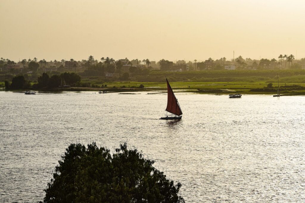
Pull up a map of the ancient world and you’ll notice something right away: the great early cities almost never sit out in the open. They crowd the banks of rivers. There’s a reason for that, and it’s not romance. A river meant drinking water, a road you didn’t have to build, fish for the table, and — most of all — soil that refilled itself every year. Where the water went, people followed, and where enough of them gathered, the first real civilizations took shape.
What follows are eight rivers that did more than cut through a landscape. Each one grew cities, fed millions, and in some cases gave a whole culture its calendar, its gods, and its sense of itself. A few you’ll know from your school days. One or two may surprise you, including a river right here at home. Think of this as a slow drift downstream through the places where the human story really got going.
The Nile
Egypt’s yearly giftIf you picture ancient Egypt — the pyramids, the pharaohs, hieroglyphs carved in gold light — you’re really picturing the Nile. Every summer the river rose and spilled over its banks, then pulled back and left a fresh layer of dark, rich silt carried all the way from the Ethiopian highlands. The Egyptians didn’t have to fight their soil the way most farmers did; the flood renewed it for them, year after dependable year. They grew wheat and barley in that black earth and called their land after it.
Permanent villages had settled along the banks by around 6000 BCE, and by roughly 3150 BCE Egypt had pulled itself together into what’s often called the world’s first nation-state. The river was so central that Egyptians treated its flood as a gift from the gods and built their whole year around it. Strip away the Nile and there is no Egypt — just desert on both sides, waiting.
The Tigris and Euphrates
The land betweenTwo rivers, one story. The Greeks called the country between them Mesopotamia — literally “the land between the rivers” — and it’s the place most historians point to when they say “the cradle of civilization.” In the flat southern floodplains of what is now Iraq, farmers learned to dig canals and lift water with simple cranes called shadufs, a trick going back to around 3000 BCE, and suddenly they could grow far more grain than they needed to eat.
That surplus is the quiet hero here. When a handful of people can feed everyone, the rest are free to become potters, priests, scribes, and kings. Out of that extra bushel of barley came the first true cities — Uruk, Ur, Eridu — along with writing, the wheel, and law. It all started with two rivers and the stubborn work of keeping their water where you wanted it.
The Indus
Plumbing before RomeAlong the Indus, in today’s Pakistan, a civilization rose that most people never learned about in school — and it was a marvel. Its two great cities, Harappa and Mohenjo-daro, may each have held 40,000 to 50,000 people at a time when a big town usually meant 10,000. Walk their ruins and you’ll see streets laid out on a careful grid, as if the whole place had been planned on paper first.
What really stops you is the plumbing. These cities had covered drains, public wells, and household bathrooms with a drainage system more advanced than anything the early Romans managed. The Indus fed the fields and filled the wells; when the rivers shifted and the climate dried out, sometime around 1900 BCE, the cities slowly emptied. A whole world, tidy and sophisticated, faded back into the dust.
The Yellow River
Rich soil, hard temperThe Chinese call the Huang He the cradle of their civilization, and they’ve had more than 3,000 years to decide. The river picks up enormous amounts of fine, yellow windblown soil — loess — as it cuts across the plateau, and that’s where it gets both its color and its gift. Drop that silt on a field and it’s some of the most fertile ground on earth. The earliest Chinese dynasties and capitals grew up along its middle and lower reaches.
But the same silt that feeds the land also chokes the riverbed, lifting the water higher and higher until it breaks loose. The Yellow River has flooded catastrophically so many times that it earned a grim nickname: “China’s Sorrow.” Generation after generation learned to coax a living from a river that could give everything one year and take it all back the next.
The Yangtze
Where rice beganIf the Yellow River gave northern China its wheat and millet, the Yangtze gave the south something arguably bigger: rice. The lower Yangtze valley is where people first domesticated rice, with early farming villages tending paddies some 9,000 years ago — among the oldest agricultural settlements anywhere on earth. That one crop would go on to feed a staggering share of the human race.
You can still feel the weight of it. Later cultures along the river turned rice farming into a fine art, with plows, irrigation, and craftspeople making jade and lacquer so beautiful we put it in museums today. A single grain, coaxed from a wet field beside a long brown river, became the daily bread of half the world.
The Ganges
Holy from source to seaThe Ganges runs about 1,560 miles across northern India, and for well over a billion people it’s not just a river — it’s a goddess. Hindus honor it as Ganga and have for ages come to bathe in its waters, scatter the ashes of loved ones there, and make pilgrimages to the sacred cities strung along its length. Varanasi, on its banks, is one of the oldest continuously lived-in cities in the world.
The Ganges plain is also one of the most crowded and heavily farmed stretches of ground on the planet, and it has been feeding dense populations for thousands of years. It’s rare to find a river that is at once a breadbasket and an altar, carrying both the harvest and the prayers of the people who live beside it.
The Mississippi
A city before ColumbusHere’s the one close to home. Long before European ships appeared, the Mississippi floodplain was home to the Mississippian culture and its largest city, Cahokia — just across the river from where St. Louis stands today. At its height around 1050 to 1200 CE, Cahokia was the biggest settlement north of Mexico, with scores of earthen mounds raised by hand.
The greatest of them, Monks Mound, still rises about 100 feet from the Illinois plain and is the largest earthwork the Americas ever produced. The river’s rich bottomland grew the corn that fed thousands, and its waters carried trade goods for hundreds of miles. If you’ve driven past those grassy mounds and wondered, now you know: you were looking at a lost American city.
The Mekong
Angkor’s engineThe Mekong snakes down through Southeast Asia, and it powered one of the most dazzling empires you’ve probably never studied: the Khmer, whose capital at Angkor ruled the region for centuries starting in the 800s. Their secret was water management on a breathtaking scale — a web of canals and vast reservoirs called barays that stored the monsoon rains for the dry months.
With all that stored water, Khmer farmers could pull three or four rice harvests a year from the same fields. A Chinese visitor who passed through in the 1290s noted exactly that, almost in passing. The rice surplus paid for the temples, and if you’ve ever seen a photo of Angkor Wat rising over the trees, you’ve seen what a well-managed river can build.
Eight rivers, eight very different worlds — and the same quiet pattern underneath all of them. Give people reliable water and renewing soil, and they’ll build something that outlasts them: a city, a faith, a way of growing food that still feeds us. Next time you cross a bridge over some wide, muddy river, slow down for a second. You’re looking at the oldest reason there are cities at all.
Frequently asked questions
Why do so many ancient civilizations start on rivers?
Rivers provided drinking water, fish, a natural highway for trade, and — crucially — floods that renewed the soil, letting a few farmers grow enough food to feed everyone else. That surplus freed people to build cities, crafts, writing, and governments. It’s no accident that the earliest states cluster along the Nile, the Tigris and Euphrates, the Indus, and the Yellow River.
Which river is called the cradle of civilization?
The Tigris and Euphrates in Mesopotamia (modern Iraq) usually get that title, because the world’s first cities and writing appeared there. The Nile and the Yellow River are often called cradles of their own civilizations too. Several of these river valleys helped produce the great wonders of the ancient world.
Did Native Americans build cities along the Mississippi?
Yes. The Mississippian culture built Cahokia on the river’s floodplain near today’s St. Louis, and at its peak around 1050 to 1200 CE it was the largest settlement north of Mexico. Its Monks Mound is still the biggest earthwork in the Americas, and the site is a UNESCO World Heritage landmark.
Why is the Yellow River called “China’s Sorrow”?
The river carries huge amounts of fine yellow silt that settles on the riverbed and slowly raises the water level until it bursts its banks. Those floods have been so frequent and so deadly over the centuries that the Huang He earned the grim nickname “China’s Sorrow,” even as its silt made the surrounding land richly fertile.
Sources
How much do you remember?
3 quick questions from the story above.
Enjoyed that? Play a full trivia quiz:
Play a Geography quiz